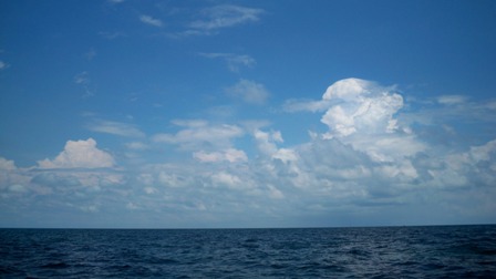
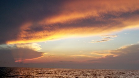
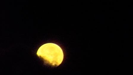
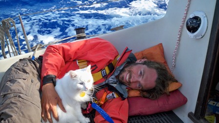
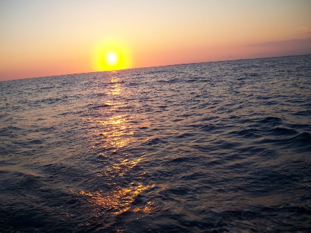
Here’s a little video clip from our Great Bahamas Banks crossing in our Albin Vega, s/v Wee Happy.
Monthly Archives: April 2011
Crossing the Bahamas Banks
We left Bimini Harbor by 9:00 and happily raised our rainbow spinnaker on a broad reach to the north. Aaaaah, crystal clear blue waters, lovely sailing, and fresh breezes. Why did we take so long to get over here?
Our basic goal in coming to the Bahamas has been going to the Exumas Land and Sea park. We have completed the first leg of the journey, which got us into Bahamian waters, but now we have another LONG leg to go to get closer the Exumas. We have to cross the Great Bahama Banks, a shallow area of about 20 feet deep for 60 miles. In that space there are no islands, no markers, no nothing. Actually, there is a few major markers on the charts — One is for Mackie Shoal. On the chart it looks like it should be a major marker, with a blinking light, or at least visible for a good distance. When we finally reached it, we found that it was nothing more than a small pole sticking out of the water a few feet. There is another point on the chart called “Northwest Channel Light”. This is the point where boats decide where they are going after crossing the banks — down to Nassau, up to the Berry Islands, etc. It is the major intersection of this great expanse. Well, there is no light there, it was also little more than a stick in the water, barely visible until you were practically on top of it. We had heard a lot about navigational aids being poor or non-existent in the Bahamas, but come on — all the boats pay a fee of either $150 or $300 to come cruising here and they can’t afford a single light to mark a major shoal???
Anyway, back to sailing. We tried to sail for a long time with our beautiful spinnaker, and it was great while it lasted. But a front was approaching and the winds started picking up, so we decided to take down the spinnaker and motor sail with our jib to try to beat the squall before it came our way. We managed to skirt the storm, and then the winds died down and became “light and variable”. Our options at that point were to anchor out there in the middle of nowhere and wait for wind, or motor across the Banks. The winds were forcast to shift to the East and strengthen, so we decided to motor across in the dead calm now rather than try to fight east winds on the nose later.
We hadn’t actually decided where we were going yet. Or options included the northern part of the Berry Islands, Andros, or towards New Providence Island where we could jump off to the Exumas. After much consideration of where the wind might blow us the best, we decided to keep with our original plan of heading straight to the Exumas. Our friends Sara and Trevor are in the Exumas and we are hoping to catch up with them. If we dallied around the Berrys or Andros, we would probably never find them. It was fun for awhile, entertaining the idea that we could just end up at whatever island the wind blew us to, the only problem is that either there was no wind or the wind was coming from the direction we wanted to go…..such is the life of “sailors”.
By 5:30 the winds started blowing out of the east–right on our nose. Knowing that it would only pick up from there, we decided we’d better book it all the way across the banks now rather than later. Heading east across the bank in a strong head wind means lots of CHOP. So we found an anchorage on the map just a few miles from the Northwest Channel “Light” and got ready for another six hours before we could stop the boat.
It wasn’t bad though. It was the night of the full moon. The sun set at 7:30 and the moon rose at 7:30 too. So we were graced with a stunning sunset in the west and anticipation of a full moon rise in the east. By the time the moon was high overhead, Dolphins came to swim with our boat–dancing back and forth underneath the bow in the moonlight. the air was warm, and we saw a few other boats pass in the night. It was amazing to be in just 15 feet of water with no land anywhere in sight for hour after hour after hour. It was truly eerie.
After midnight we were exhausted. We’d gotten up at 06:30, so it had been a long day. We made it just northeast of the Northwast Shoal marker which actually doesn’t exist. It’s now just a GPS cooardinate on the chart of where a marker used to be. Regardless, we anchored a mile northeast of it which would keep us safely out of the channel but close enough where tomorrow we could get right back on our route.
A while after we stopped and settled into being still the cats came out of hiding and explored the deck of the boat. Mojo meowed the most mournful cry that seemed to say “HELLLOOOOOOOOOOOOOOOOOOOOOO???????” “Is ANNNNYYYYYoOOOOONNNEEEEE OOOUUUUUUTTTTTT TTHHHHHHHEEEEERRREEEE???????” We could tell he was thinking “where the hell are we? what the F…?”
so we rigged up a cob-jobb of a laser pointer with some old AA batteries and some wire and tape. That did the trick of pulling them out of their comas. they had been sleeping since Florida, you know! Theyy just love the little red dot from the laser pointer. We roughed them up a little, and then they got into a wrestling match with eachother which worked out some of their latent agression.
We on the other hand, left on every light that we have on the outside of the boat, set the anchor alarm for 400 feet and set the wake up alarm for 06:15 and then passed out sharing our bed in the v-berth with the dinghy’s outboard motor. Sweet. Our first threesome.
It was almost unreal to be on the ocean in 15 feet of water under a full moon with the water as smooth as a calm lake but translucent enough to see the bottom by the moonlight. What a weather window we had to get across the banks. It could only have been improved if we’d been able to sail the whole way rathern than having to motor half way. It’s good that we did though, because the next morning the winds would be out of the southeast and stronger…on the nose again, of course.
Nice Beach!
Napping on the crossing
Greeting the sunrise on our crossing
Here is a short video of us greeting the sunrise while crossing the Gulf Stream from Islamorada Florida to Bimini Bahamas in Wee Happy, our Albin Vega sailboat.
Current Plan
Okay, we’ve looked at the weather and here is our plan. We are going to leave bimini now and head across the Great Bahama Banks to the Berrys. We’ll have to anchor on the banks tonight and then finish the crossing tomorrow.
the winds are supposed to shift to the East and strengthen for the next week, so if we make it to the Berry’s we can then sail to the Exumas or Nassau or Andros in the east winds. If we stay here then the east winds will lock us in for a week or we’d have to motor into the east winds to get anywhere.
Heck with that!
So we’re taking off now to cross the banks and will check in when we get to the Berrrys.
Taking our Albin Vega to the Bahamas across the gulf Stream!
We left Islamorada at 5:00pm on Friday. We sailed out towards the edge of the reef as the sun descended in the west. We debated about anchoring at Rodriguez Key to sleep for a few hours or the entire night before taking off on the crossing. The weather was nice, though, and the forecast was in our favor. We figured that if we stayed the night and left in the morning then we wouldn’t have enough time to make it into the Bahamas before sunset on Saturday. As it turned out, we were thinking right.
So we decided to keep going and cross the gulf stream on an overnight passage. We got out to the reef that protects the Keys as the sun was setting. We blew our conch shell to the four directions as it dipped beneath the horizon. The depth meter started displaying deeper and deeper depths until it finally read “—“ meaning depth in excess of 200 feet.
We wanted to actually sail to the Bahamas, not motor like everyone other “sailor” that we know. Most sailors leave from a launch spot as close to the Bahamas as possible, like Miami, in order to minimize the time in the gulf stream. We’ve even had professional sailor captains try to convince us to just motor full-throttle the whole way to “just get there.”
We calculated our course on paper to account for the northern 2 knot+ current of the gulf stream. It indicated to us that if we wanted to sail and not motor, we’d have to launch from a spot far south of Miami and Bimini. As it worked out, leaving from Islamorada was just the perfect amount of distance south to allow us to sail all the way to Bimini. Our calculated compass heading that we would maintain for the entire trip was an easy one: 90degrees. That’s due east, magnetic. Simple enough! All we had to do was point our bow due east for 19 hours, and we’d end up in the Bahamas 80 miles to the northeast.
We were both nervous about the crossing. It’s the first time we were going across a major ocean current on a significant open water ocean passage, and we were doing it alone without a buddy boat. Not only that, but we were going to actually SAIL it and not motor it, and we were leaving from a jump off point that no one leaves from, and we were doing an overnight when most everyone crosses starting at dawn. Leaving to cross at night can really be scary. But, the weather was perfect and delicious, so there was nothing to hold us back but ourselves.
We said our good-byes, send last emails and made the last phone calls that we could until our cell signal ran out on us. Then we were truly out of range of all friends and family. The wind was mostly out of the east-southeast, so we had to sail close-hauled and beat to windward the entire trip. It wasn’t bad, but when the wind shifted a bit to the east (on the nose), we actually had a few hours when we had to motor to keep up our speed so that we would make Bimini and not get blown by the gulf stream current too far north.
There was a significant amount of BIG boat traffic out there. We had to slow down and alter course to allow two separate cruise ships to pass and also once for a container ship and another time for a fuel barge being pushed by a tug. This was all under the near full-moon light on gleaming water only seeing the boats by their lights. It’s so difficult to figure out how far away the boats are, what direction they are heading, and what spped they are traveling at night just based on their lights. Thank goodness we have a pair of good binoculars! We were able to assess their heading and speed well enough to navigate safely around them with lots of comfort room.
Had one accidental heave-to in the night due to complications with a change in wind speed and direction and the autopilot’s inability to compensate quickly enough. We had to start the motor again and run on fuel for an hour until the winds picked up and shifted southeast again. While we were motoring in the luminous moonlight over the 2000 feet deep water, three dolphins came and raced us. The water was so amazingly clear that even just by moonlight we could see them swimming in the water aside and beneath our albin vega. They seemed to have mottled or spotted backs rather than the usual all gray dolphins we have seen in the keys. They were really hauling fin too, because we were cruising at 5 knots at that point.
We took shifts on deck while the other got to rest in the cabin below. At times it was a bit of a bucking bronco ride, but overall it was just a stimulating sail for 18 hours. We had picked a good weather window. The swells were maybe 5 to 6 feet with maybe 1 foot waves on top of them, all from the southeast. After experiencing this “calm” night, we definitely don’t want to ever experience it in BIG conditions.
By morning we were both very tired, but the color of the water was rejuvenating. Imagine grey merging with lapis lazuli. We caught the Bahamas weather forecast net on the shortwave radio at 6:30am, and the sun rose behind the clouds on the horizon at 7:00am. By 11:00am we were within 1 mile of our goal: North Bimini, Bahamas. We had traveled 85 miles over open ocean with a somewhat predictable current and a decently cooperative weather forecast. It was amazing to us that we didn’t miss the wee little 2 mile island in all that open water. We arrived spot on our target after 18 hours of pointing our bow at 90 degrees. Amazing! It worked! We arrived within 100 yards of our goal waypoint without even having to correct our navigation or heading.
By 12:00 noon we had found a marina for $30 for a slip, and we were eager to tie up and rest. We considered just continuing on across the Great Bahama Bank towards the Berrys or Nassau or Andros, but we were too tired to just start another 80 mile trip without rest. We raised our quarantine flag and went to the customs and immigration office, a bit worried about whether or not they would turn us away because of our two cats.
It really comes down to the luck of which agent you get at the counter! The guy next to me got asked about having pets on board, but I didn’t. If I’d have answered “yes” then most likely our cats would have been quarantined for a month or we would have been denied admittance to the Bahamas. Phew! The agent gave us our entry visa and cruising permit and fishing license, and that was that. I lowered the quarantine flag and raised our new Bahamas flag on Wee Happy. We are now official and able to cruise the Bahamas until we want to leave or our permits expire on July first, whichever comes first.
So now we are planning our next trip: crossing the Great Bahama Bank to the Berrys or Andros.
We made it to Bimini!
After a long 18 hour passage through the night, we arrived at Alicetown, North Bimini, Bahamas at noon today.
We just found wifi, so we are posting a quick note to our friends to tell you all that we are here and in good health.
We’ll post the story of the crossing soon along with pictures.
The plan is to leave here tomorrow to cross the Bahama Banks to the east and get to Nassau or the Berrys or the Exumas.
– Capt’n K & Lala
leaving for the Bahamas now.
We’re heading out! We just pulled our anchor and are heading out to the gulf stream past the reef.
Here is our plan: 85 nautical mile passage from Islamorada Florida to Bimini Sands Marina, Bimini, Bahamas. True course 56 degrees. Assuming that we average 4 knots, our compensated course to steer is a heading of 82 degrees. We’ll see what the current is when we get out there though, and we will probably have to modify that a bit.
We stowed our dinghy on the deck, deflated, with the outboard in the v-berth. Everything looks good. The weather is for south to southeast winds of 10 to 15 knots for tonight and tomorrow, so hopefully we can sail the whole way! Gas is expensive, but we have 25 gallons on board if we need them.
When we arrive at e Bimini Sands Marina, we should have internet access, and we will post to let everyone know how it went and that we’re okay. So if you don’t hear from us by Saturday night then we are overdue.
Then we’ll check in with customs and consider the next leg of the trip from there.
So thanks for tuning in! Your thoughts and prayers are welcome.
– Capt’n K & Lala
Ray Migration

check this out! It’s a shot from the bow of the annual ray migration in Mexico! (we did not take this photo, as we are en route to the Bahamas, not Mexico. Just a cool photo we wanted to share, and we are testing our new iPad application to upload photos).
Right now we are in Islamorada at my favorite restaurant, Loralei’s. They have the best Key Lime Pie in the entire world and Im eagerly awaiting my slice of heaven.
– Capt’n K & Lala
